Thursday, May 9, 2019

Pipe Spring National Monument: Paiutes, Mormons and Stephen Mather


A bit of water voices diverse human stories in Northern Arizona


Water defines the arid west.  Sporadic and intermittent water - think flash floods, freeze/thaw and steady erosion - sculpts the landscape, but it takes permanent water to create conditions for human settlement.  At Pipe Spring National Monument in northern Arizona, the Park Service has done an exemplary job of telling the human water story from three perspectives: Paiutes, the original inhabitants; Mormons, a big wave of Anglo settlers that stayed; and the U.S. government.

Pipe Spring gets it start as rainfall.  About 10-12 inches fall here every year, but only an inch works its way through the red sandstone and into the aquifer.  When that water hits the impermeable mudstone layer below the sandstone, it finds its way to the surface creating springs along the base of the red sandstone mesas.  There are actually five springs at Pipe Spring and they have supported human habitation since the ancestral Puebloans lived in the region some one thousand years ago.  Because of this generous and reliable source of water, there was historically and still is a well-worn trail to Pipe Spring.  Remnants of the historic wagon road leading to the site are visible from the mesa above the spring.  Today the trail is Arizona Highway 389.

When catholic missionaries seeking a route from Santa Fe to California first showed up in 1776, Paiute Indians lived in the area and used water from Pipe Spring to grow beans, squash and corn.  Anglo ranchers began utilizing the water in the late 1850s and in 1863, James Whitmore, a Mormon Rancher, homesteaded the land around and including the spring for his 11,000 sheep and 500 cattle.  Meanwhile, Kit Carson was busy displacing the Navajo Nation from their ancestral lands.  Displaced parties of Navajo were raiding in the Pipe Spring region and they killed Whitmore and a ranch hand in 1866 as Whitmore sought to recover stolen cattle.  Only local ranchers thought it was the Paiutes who killed Whitmore and the ranch hand, causing a conflict that really shouldn’t have happened.  The Paiutes were not an aggressive people and they had co-existed with the Mormons and shared Pipe Spring since the first contact with Mormon ranchers.

Our NPS Interpretive Ranger, Miranda, noted that individually Paiutes and Mormons got along quite well.  The Church didn’t subscribe to the “only good Indian is a dead Indian” mentality that was prevalent at this time in our history, though there were some armed conflicts between Mormons and local tribes.   Seeing Native Americans as the lost tribe of Israel, the church sought to work with and live with these indigenous peoples.  And there was a tremendous push to convert the Paiute to Mormonism, which didn’t work out very well.  Culturally there was continual conflict and misunderstanding over concepts of values, religion and land ownership.   For example, Paiutes could not understand why Mormon settlers could shoot deer whenever they wanted, but the Paiute could not shoot cows.

Winsor Castle

The perceived threat from the Paiute, caused by the misunderstanding over who killed Whitmore, and continuing raids by the Navajo ultimately led to the construction of a small stone fortress over the main spring area after Brigham Young purchased Pipe Spring from Whitmore’s widow in 1870.  Effectively cut off from water they had used for centuries, the Paiute were forced away from the spring and lands they desperately needed for survival.  Many Paiute died of disease or moved away as there was no federal government assistance, no treaty and, therefore, no local reservation until 1907.

Inside Winsor Castle

This small stone fortress, called Winsor Castle after the first ranch manager Anson Winsor, was constructed between 1870 and 1872 by 40 men from the Mormon Church.  Red sandstone was quarried locally, but the roof timbers had to be cut and hauled from as far away as 50 miles.  The church used Whitmore’s ranch and Pipe Spring as a “tithing” ranch.  The Mormon Church required a 10% tithe from its members, many of whom could not pay in cash.  So they paid annually in cattle and sheep which were raised on church owned ranches.  Milk cows from Pipe Spring generated 40 pounds of butter and 60 pounds of cheese every day!  They also cultivated and irrigated a 10 acre garden that included pear and apple trees.   A couple times a month, wagons of produce, butter and cheese along with several dozen steers were sent to feed the workers building the Mormon Temple in St. George, a three day wagon ride away. 

Sitting Room inside Winsor Castle

Ranger Miranda gave an excellent tour of Winsor Castle, which the Park Service has meticulously restored to what it looked like in the 1870s.  Tours start on the hour from 10 am to 3 pm daily.  The house is built like a fort with high stone walls and thick wooden gates, but it was never attacked.  The tour starts on the first floor sitting room and dining room.  Upstairs are the sleeping quarters, including a “bridal suite” for newly married Mormon couples traveling to and from the Temple in St. George where their marriages were sealed by the church.

Telegraph connected Winsor Castle to Salt Lake City

Something that really caught my attention was a telegraph wire on the balcony leading into the house.  We learned from Ranger Miranda that even before the house was constructed, Brigham Young had decreed that the far-flung outposts of the Mormon empire would be linked by telegraph to Salt Lake City.  Post-Civil War there was plenty of telegraph wire to be had cheaply.  Brigham Young took advantage of its availability to string 995 miles of wire linking remote sites, like Pipe Spring, from Idaho to Arizona.  The telegraph operators were all single women who had their own space on the Castle’s first floor, just above the basement room built over the spring.  The spring kept this basement room cool where butter and cheese were stored.

There is an RV park owned by the Kanab Paiute adjacent to the monument, but we had been camping for a month so sought out a real bed for a couple nights in Kanab, Utah.  About 30 minutes from Pipe Spring, Kanab is the place for lodging and restaurants and it boasts of a long history supporting mostly western movies and TV shows filmed in the area. There is interesting movie trivia signage all over town. Pipe Spring can be seen in the TV series Death Valley Days and the film Last of the Mohicans.  And at the visitor center, I learned that Winsor Castle was the inspiration for the Withersteen Ranch in Zane Grey’s “Riders of the Purple Sage.”  Kanab hosts an excellent book store/coffee shop/outdoor store (a wonderful combination) and several good restaurants, including our favorite, the Flying V CafĂ©.  For a quick bite and a local beer after visiting Pipe Spring, we drove a short 18 miles to Colorado City, Arizona and the Edge of The World Brewery.  For a town historically steeped in Mormon fundamentalism, it was quite a treat to discover good pizza and cold beer!

The government first interacted with Pipe Spring when John Wesley Powell based out of the area while surveying the lands north of the Grand Canyon.  It was his survey that placed these lands not in the predominantly Mormon Utah, but rather in Arizona.  Powell was the first government representative to suggest federal support in the form of food and farm land for the Paiute.  No one in Washington listened until 1907 when the General Land Office withdrew 138,000 acres for the Kanab Paiute.  The next big government influence came in 1920 when Stephen Mather, the first Director of the National Park Service, visited the site while on an automobile tour of the new big parks in the region.  He foresaw Pipe Spring as a future stop between Zion and the Grand Canyon on a National Park-to-Park Highway as the automobile became more and more prevalent and more and more visitors came to the region. 

NPS has replicated the Castle's garden

The Mormon Church had divested itself of Pipe Spring in 1895 and the Park Service purchased its 40 acres from private owners in 1923 with funds donated by Union Pacific Railroad, the Mormon Church, some private individuals and Mather himself.   The Park Service has a very nice visitor center, a reconstructed garden and orchard, livestock including cattle and chickens, and a short trail that leads above the site to a scenic view of the castle and surrounding lands.  Ironically all this development has had a negative impact on the spring’s water flow.  Wells dug by NPS, the local Kanab Band of Paiute Indians and local ranchers have reduced the flow from 50 gallons/minute to 5 gallons/minute.  NPS hydrologists speculate the spring could dry up within 10-20 years.

The 1923 presidential decree establishing Pipe Spring as a “memorial of western pioneer life” has been expanded as the Park Service developed the story here.  It is a story not only of pioneers, but also the original inhabitants and what happened when their culture collides with the pioneer life.  And it’s the story of the Park Service bringing these valuable perspectives to our attention.  Should you ever find yourself on Highway 89 in Kanab, Utah or on Highway 389 just outside of Colorado City, Arizona, follow Stephen Mather’s vision, pull your car over and spend some time at Pipe Spring. 

Saturday, March 30, 2019

Kobuk Valley, Great Sand Dunes and White Sands: Digging into Mother Nature’s sandbox


Hiking the shifting sands in three of the Park Service’s iconic dune fields


Great Sand Dunes National Park & Preserve


Sand dunes conjure up memories of family camping trips to the Oregon Coast where my sisters and I would roll down steep dunes only to giggle our way back to the top and do it again.  Over and over, as only kids can do.  At that age I thought sand dunes were exclusively an ocean thing.  But as I grew older, I learned that sand dunes are also found far from the ocean.  I’ve recently explored some great inland sand at Kobuk Valley National Park in Alaska, White Sands National Monument in New Mexico and Great Sand Dunes National Park & Preserve in Colorado.

Living in Alaska for the past 38 years gave me a unique opportunity to visit some exceptionally cool and out-of-the-way wilderness in our 49th state.  When I started with the National Parks Conservation Association in 2002, I quickly embraced the need to visit all 16 of Alaska’s national park units.  That included Kobuk Valley National Park, located about 35 miles north of the Arctic Circle and only accessible by small plane or river boat.  Kobuk Valley has been a park since the Alaska National Interest Lands Conservation Act was signed by President Carter in 1980.

There are actually 3 dune fields in the park, remnants of a much larger 200,000 acre dune field that was created during the Little Ice Age, which began about 28,000 years ago.  The area around Kobuk Valley was not glaciated so the winds gathered sand scoured by the surrounding glaciers and created the dunes.  When the ice retreated about 14,000 years ago, the boreal forest began reclaiming the sand leaving us with the three remnant dune fields we have today.  The largest is the Great Kobuk Sand Dunes, 16,000 acres of the best and most accessible sand in the most northerly active dune field in the world.

Visiting Kobuk Valley and the Great Kobuk Sand Dunes begins with an Alaska Airlines flight to Kotzebue where we chartered a small plane (see the park’s commercial operators for air taxi options) for our three day dune camping adventure.  Some air taxi operators land on wheels in the dunes and others land on floats on the Kobuk River.  I had been there once before with the Park Service and knew about the sand landing option which saved us from a two mile hike from the river through the mosquito-infested boreal forest to the dunes.  It is much easier to land near where you want to camp. 

There were four of us, including several NPCA staffers from Washington DC.  My supervisor was pretty nervous about camping in bear country. Just because we were camped on sand doesn’t mean there are no bears, so I secured a small electric fence to put up around her tent so she could sleep anxiety free. We saw both wolf and bear tracks in the dunes and I made certain my traveling companions understood how to behave in bear country.  Each had their own can of bear spray.  You need good backcountry experience to do this trip safely.

Hiking on sand dunes, surrounded by boreal forest above the Arctic Circle was surreal.  Before I got there, I could not imagine sand dunes in the interior arctic.  We spent two days exploring on day–long walks, marveling at the wave patterns in the sand created by the ever present wind, hiking to the top of the higher dunes and rolling down like we were kids, and photographing wildflowers growing in sand.  The Western Arctic Caribou Herd migrates through this area and we wished our trip had coincided with the right time of year to experience caribou on sand.  And we pondered just how long before the forest totally reclaims these dunes.  It won’t happen for a while, so you have plenty of time to get out here and enjoy this totally unique park. 

Great Sand Dunes National Park & Preserve in Colorado is a much bigger and more accessible dune field.  These are, in fact, the highest dunes in North America and have been protected since local residents successfully lobbied for a 1932 national monument proclamation.  The area was expanded to its current boundaries and renamed a park and preserve in 2000.  The sand captured in these dunes originated about 65 miles west in the San Juan Mountains.  As the sand blew east it mixed with sand and pebbles washed down from the Sangre de Cristo Mountains and it was all stirred together in an ancient lake.  As that lake receded, the prevailing winds from the west pushed the sand up against the Sangre de Cristo Mountains and created dunes that today are over 750 feet high.

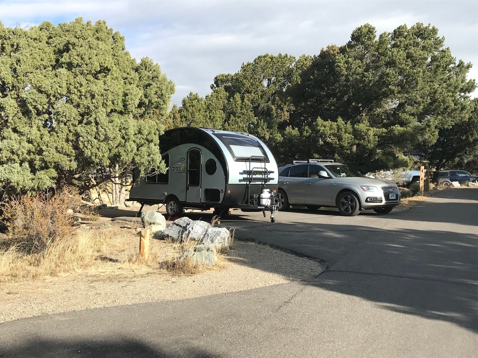
Camping at Pinon Flats Campground in our Alto trailer

My girlfriend Craig and I rolled into the Pinon Flats campground mid-afternoon and easily found a place to park our little Alto trailer for a three day stay.   The campground is open April through October and reservations are accepted from May to September.  In addition to information on how to safely explore the dunes, the visitor center oriented us to hiking options in the juniper-pinon woodlands at the dune’s edge, as well as trails to higher elevations into a subalpine and alpine tundra environment in the Sangre de Cristo Mountains.  We didn’t get into the high country, preferring to explore the sand.

The campground is a stone’s throw to the dune field, so we hiked from our campsite.  Medano Creek is your first obstacle.  We were there in October, so it was very shallow and easily crossed without getting our boots wet.  A unique feature of this creek are these mesmerizing wave-like pulses of water caused by water building behind small ridges of sand in the creek bed and as these ridges give way, a small surge of water flows downstream.  We timed our crossing to avoid these pulses, dancing across the stream and on to the dunes.

Medano Creek and Sangre de Cristo Mountains

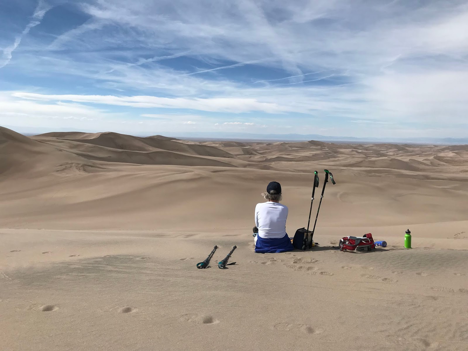
The dunes are a series of windblown ridges and we set our sights on a mid-dune ridge about halfway up.  The thought of climbing up 750 feet in shifting sands to the top of Star Dune (one of the park’s highest) made my calves spasm in anticipation.  But once we started out, the sand was firmer than we expected.  We were not climbing where many others had gone and later we found that once the sand was loosened by lots of hikers on the more popular routes, it was a bit of a grind.  But on this less-traveled sand we easily walked up ridges that beckoned us to see what was beyond the next highest one.  Soon we were on top, standing on Star Dune and gazing across thousands of acres of shifting sands.  And, as in Kobuk Valley, we discovered life on the dunes.  We followed tracks of beetles, had ladybugs land on our hats, watched ravens surf the wind and wondered where butterflies thought they would score some nectar high in the sand.  And coming down was way easier and a lot faster than climbing up!


Coming down off the dunes!

The next day the wind was really blowing and hiking on the sand was a non-starter.  Good thing we did our dune walk when the wind was but a mere whisper.  So we explored the juniper-pinon forest on the Wellington Ditch Trail, just above the sand edge – a very reasonable one-mile trail from the campground to the visitor center.  As an added bonus, after years of looking, I saw my first pinon jays!!  A whole flock went squawking by and I imagine my “I-just-saw-the-bird” dance was a little amusing for those on the visitor center deck.  Glad I was able to entertain them! 

One more ridge beckons us!

This is very much a "local" campground with lots of campers from Pueblo and Colorado Springs.  On one of our campground walks, we ran into a group of Boy Scouts and their leader told us about a nearby hot springs.  Our aching muscles rejoiced!  Don’t let the name get in the way – Sand Dunes Swimming Pool and RV Park.  It is about an hour away in Hooper, CO and, in addition to the swimming pool that was full of kids, there is the Greenhouse, an adults-only section with four different soaking pools of varying temperatures and a bar!!  We took advantage of a nice hot soak to ease the muscles that were talking to us after our day of hiking in sand.  And on the way over, we stopped off at San Luis State Wildlife Area to watch the Sandhill cranes come in for the evening.  A fine way to end the day.

White Sands National Monument in New Mexico doesn’t have the elevation of Great Sand Dunes – most of the dunes we hiked on were well under 100 feet high – but it is no less of a cool place.  Nestled into the Tularosa Basin just east of Las Cruces, New Mexico, this 275 square miles of white gypsum sand is the largest of its kind in the world.  Alamogordo is actually the closest town to White Sands, but we were traveling down I-25 from Santa Fe, so stayed in Las Cruces.

In the most recent ice-age, the one that also helped form the Great Kobuk Sand Dunes, gypsum was eroded from the surrounding mountains and collected into what is now known as Lake Ortero.  As that ice age retreated some 12,000 years ago, the gypsum deposits on the lake bottom had grown to as much as 3 feet thick and were exposed to the wind.  As the exposed gypsum crystals were broken down into smaller particles, they became the white sands that we see today.


White Sands National Monument - dunes and the vegetated bed of ancient Lake Ortero

The dunes here are very close to the water table, which does two things.  First it allows for vegetation to grow.   Deep roots on plants like the skunkbush sumac will hold sand in place and create pedestals when the surrounding dunes move on.  These little vegetation islands provide denning habitat for kit foxes.  The second advantage of a high water table is keeping the sand moist and firmer than regular dunes.  This makes for great hiking.

For over 100 years, nearby residents knew they were living next to someplace special.  The first attempt to protect these sands was in 1898 when residents of nearby El Paso, Texas proposed Mescalero National Park.  That didn’t fly and neither did a proposal in 1922.  But in 1933 President Herbert Hoover listened to a group of Alamogordo citizens and used The Antiquities Act to create White Sands National Monument. 

In addition to the recreational opportunities that abound here, White Sands is also known for its military history.  The monument is surrounded by the White Sands Missile Range (think atom bomb testing) and Holloman Air Force Base, and the monument is occasionally closed for missile testing.  There are signs at trailheads warning hikers not to approach any ordinance they might find stuck in the sand.

Watch out for bombs on the trail!

We started off at the Works Progress Administration built visitor center to get oriented on what to do and where to go.  This is a very classic adobe style building at the center of a national historic district protecting all the WPA era buildings at park headquarters.  This is a fee park and the eight mile road leading to the Heart of the Sands picnic area begins at the entrance station.  There are several great trails to explore along this road and there are lots of signs about what you cannot do in the dunes, including having alcohol from February 1 to May 31.  This was a bit confusing until we learned that this was a big spring break party spot…until NPS banned alcohol.


Within the first couple miles is the Dune Life Nature Trail, the Playa Trail and the Inter-dune boardwalk.  We did all three and each was a bit different.  The Dune Life Trail is along the edge where the desert scrub meets the gypsum sands.  It is a one mile loop that got us into lots of vegetation and vegetation pedestals.  There are 14 interpretive trail signs hosted by Katie the Kit Fox, the trail’s mascot, marking the way.  This is a well-designed and interpreted trail.  The Playa Trail is a one-half mile out and back trail that took us to the edge of a small dry lakebed that seasonally has a bit of water.  Skip this one if you are short on time.  The accessible Boardwalk Trail is a .4 mile out and back trail that is a self-guided experience interpreting the wildlife and vegetation in the heart of the dunes.

Solitude at White Sands National Monument

But by far the best way to experience the white sands is to take several hours and hike the 5 mile loop of the Alkali Flat Trail.  This trail gets you into the heart of the sand where you hike up dunes, walk along ridges and down across exposed areas of the vegetated hardened gypsum lake bed.  There are wands in the sand to keep you on track, so it is virtually impossible to get lost.  But in case you do, there is cell coverage.  This was one of our best hikes of the year and one I’d do again in a heartbeat.  We left most people in the first quarter-mile and had the dunes to ourselves.  There are no interpretive panels, just the opportunity to explore the sand, listen to the silence, share the space with horned larks, watch the weather against the surrounding mountains and experience the solitude of being in the middle of thousands of acres of moving white sands. 

We thoroughly enjoyed all three of these very different sand experiences and look forward to exploring more of the park system’s sand dunes.  Anyone up for Indiana Dunes?


Sunday, February 24, 2019

Fossil Butte and Dinosaur national monuments: Prehistoric Bones for all ages


Looking for fossils and fossil hunters in a gorgeously beautiful and remote part of the West


Kids of all ages love dinosaurs.  As a six year-old, I remember playing with plastic dinosaurs with names like Brontosaurus, Triceratops, and Tyrannosaurus Rex and imagining around 100 million years ago when those big reptiles walked the earth.  It kept me occupied for hours.  A recent visit to Fossil Butte National Monument in Wyoming and Dinosaur National Monument in Utah rekindled my childhood dinosaur interest.  And while plastic dinosaurs are prevalent in the book stores at both places, the joy of these sites is seeing real fossilized dinosaur bones and visualizing the gargantuan size of these beasts and pondering how their bones stayed preserved for us to enjoy today.

My girlfriend Craig and I were traveling through that remote part of the West where Utah, Wyoming and Idaho meet on the front-end of a month-long trip to add a few more stamps to our national park passports.  Fossil Butte is in Wyoming and there is no camping available, so we settled into a great campsite at Utah’s Bear Lake State Park about an hour away.  There are not a lot of beer options in rural Utah but fortunately Bear Lake is close enough to Idaho that we were able cross the state line and hit Cooper’s, a local sports bar, for a little college football and cold beer before we went fossil hunting.  Each state provided a critical component of our Fossil Butte visit!

Bear Lake State Park

All of this region was once under what paleontologists call Fossil Lake, a sub-tropical lake that existed back in the Eocene Epoch 34 – 56 million years ago.   Since then, erosion has carried away much of the old lake sediments, exposing fossil layers in the remaining hills and buttes.  Today this region is part of the larger Green River Formation and hosts an amazing assortment of well-preserved plant and animal fossils, including an especially rich 18-inch sediment layer from the bottom of ancient Fossil Lake that serves up some of the best preserved fish fossils in the world.

Fossil Butte

Fossils at Fossil Butte were first reported by government scientists in the mid-1800s.  When the Oregon Shortline Railroad was built through the area in 1881 and the town of Fossil was born to support the railroad, regular fossil collecting began in earnest.  The most famous collector was Robert Lee “Peg Leg” Craig who had lost his leg in a mining accident, but that didn’t slow him down.  He collected in the region for 40 years beginning in 1897 and was featured in a 1934 National Geographic article.  Another famous collector was David Haddenham, who collected on the site now protected by the National Monument.  His cabin, which he used during the summer collecting months, still stands and is accessible on the Historic Quarry Trail.  It is a pretty rustic affair and one can only imagine the primitive living conditions as he dug fossils out of the hillside above the cabin.

Craig at Haddenham's Cabin

These men, and others, started what continues today as a thriving private fossil industry fed by 11 quarries located on private land (which is only 1% of the total fossil bearing lands) and several more on state land leases.  There are two scientific quarries found on federal land, one of them being Fossil Butte National Monument.  We visited Ulrich’s Fossil Gallery, one of these private quarries, and purchased a beautiful specimen which now hangs in our house.  It reminds us daily of just how insignificant we are in the grand journey of life on our planet.  The Ulrich’s website has good videos on how these fossils are quarried and prepared for sale.

Priscacara and Diplomystus from Ulrich's quarry

Our visit to Ulrich’s didn’t include watching fossils being cleaned and prepared, but a visit to the Park Service Visitor Center showed us how it is done.  An NPS employee, using a very small air brush, demonstrated how the surrounding rock layers are carefully scoured away to reveal the fossil underneath.  This alone is worth the stop at the visitor center.  The bonus is over 300 fossils on display, including a 10 foot-long crocodile!  The visitor center also provided us with a trail map that guided us into the hills above the visitor center for a 1.5 mile loop hike through sagebrush and aspen. The monument’s self-interpreted nature trail starts and ends at a nice shaded picnic area where we had lunch. 

Author at the Visitor Center

The coolest hike is the 2.5 mile Historic Quarry Trail loop.  It is a bit of a climb up to the fossil bearing layers (650 feet), but the Park Service has done a great job of providing safe access to this historic quarry and, of course, it is well interpreted and you can see fossils in place.  If you only have time for one hike, do this one.  It is along this trail that you can experience the primitive conditions that David Haddenham lived in while quarrying fossils a hundred years ago.  Congress protected these fossil bearing hills in 1972 to tell the story of these fossils and historic fossil collectors.

Trail up to the quarry

The next stop on our fossil journey led us on a very scenic drive from Fossil Butte through Flaming Gorge and the High Uintas to Dinosaur National Monument.  Dinosaur is listed under Colorado on our national park app, but the easy and must see places to visit are in Utah.  We camped for three days at the Green River Campground, beautifully located right on the river a few miles downstream from its confluence with the Yampa.  Campsites can be reserved ahead of time, though we rolled in mid-afternoon and had no problem getting a site. There is plenty to see and do at Dinosaur and with any visit to a new park, it starts at the visitor center.

Flaming Gorge

The Quarry visitor center, which is open all year, is just down the hill from the monument’s biggest and must-see attraction, the Quarry Exhibit Hall.  And while you can drive to the hall, we strongly suggest you take the 1.2 mile Fossil Discovery Trail and see how many fossils you can find along the way.  The exhibit hall, first built in 1958, covers an entire hillside of Jurassic era dinosaur fossils (150 million years old) that are just emerging from the ground.  This hillside was once a river bed, which is why so many bones are found here and it is a rare opportunity to see them in place.

Inside the Exhibit Hall

This amazing stash of dinosaur bones was first discovered by Earl Douglas in 1909 when he was prospecting for the Carnegie Museum.  Douglas spotted 8 large bones sticking out of the ground and began excavating.  For the next 15 years, until 1924, several hundred tons of fossils were collected and shipped to museums and universities all across the country.  It was Douglas, in a letter to the Smithsonian in 1923, who first suggested leaving some bones in place for the public to view.  This amazing collection of fossils prompted President Woodrow Wilson to use the Antiquities Act in 1915 to create the initial monument which President Franklin Roosevelt then expanded by 200,000 acres 33 years later.

Fast forward to 1952 when the Park Service resumed work on the quarry site to realize Douglas’s idea of exposing bones in-place for the public to experience.  The first fossil shelter was built in 1958 with final quarrying to expose bones completed in 1992.  Shifting soils made the first shelter unstable and the site closed for a five year rehabilitation, reopening in 2011.  The current version is not to be missed.  The park’s brochure says there are over 1,500 fossils embedded in the rock covered by the exhibit hall.  We spent the good part of an hour checking it out.  And while they let you touch a few of them, be sure and take your binoculars so you can see the rest up close and personal.

Author with a Camarasaurus femur

But there is more to Dinosaur than the fossils. On our first visit to the visitor center, one of NPS’s many awesome Park Rangers suggested two hikes that we both thoroughly enjoyed.  On the north side of the monument, about a two hour drive from the campground, is the Jones Hole Trail.  Named by John Wesley Powell in 1869 for his expedition photographer Stephen Vandiver Jones, this trail begins at a U.S. Fish & Wildlife Service fish hatchery and drops 600 feet over 4 miles down to Jones Hole on the Green River. 

Jones Hole Trail on a beautiful October day

This was one of the best hikes of our month-long journey through a dozen or so national park sites in the Intermountain West.  The canyon walls at the beginning of hike are steep, shear and colored the awesomely beautiful sandstone red you find all over Utah.  The trail is in good shape and follows the well-watered stream through lush vegetation featuring box elder and juniper.  It was fall, so the yellow box elder against the red rocks, blue sky, and tumultuous white clouds (courtesy of hurricane Rosa) made the hike’s visuals eye-poppingly gorgeous.  We watched fish in the stream and spotted a good diversity of birds including Wilson’s warbler, Townsend’s solitaire, and spotted towhee.  The rangers told us to look out for desert bighorn, but they eluded us.  The trail took us by some very cool pictographs on the canyon walls and, best of all, we saw NO ONE though we danced a bit with a late afternoon rain shower.

Pictograph left by the Fremont People

The other great hike was much closer to where we were camped.  The Sound of Silence trail is a 3.2 mile loop starting at a trailhead about 2 miles from the visitor center.  This self-guided trail winds its way down washes and along ridge lines through numerous colorful rock layers.  A very informative trail guide discusses the geology, vegetation, and the impact of ancient and recent erosion on the landscape.  It was a wonderful hike that links up with the Desert Voices Trail, another loop starting from the Split Mountain picnic area on the Green River, to make an even longer hike. 

Craig on the Sound of Silence Tral

The highlight of our Sound of Silence jaunt was watching a rock wren and plateau fence lizard battle it out on the trail right in front of us.  It ended in a standoff with the lizard’s tail in the wren’s mouth and the lizard’s jaws firmly clamped on the wren’s leg.  Mother Nature running wild just a few feet in front of us!  It was one of the few times I wished I had a really good camera.  Another highlight of the hike was a steep climb up a sloping rock face to a 360 degree view of the landscape that is Dinosaur National Monument.  If you can take the heights, scramble up this rock face for the view.

Author on top of the steep climb

We also did the Cub Creek Road auto tour which highlights petroglyphs made by the Freemont people some 1,000 years ago.  At one of the petroglyph stops we shared the experience with a busload of kids from Salt Lake City – part of a Park Service program called Concrete to Canyons that started in Zion and is being expanded to Dinosaur.  The excitement of city kids being introduced to the natural and cultural wonders of our park system is inspiring.  The auto tour ends at the historic Josie Morris Cabin, part of a small ranch Josie lived on from 1914 to 1964. 

Petroglyph left by the Fremont People

Josie was a wild one.  She was married five times, was an alleged associate of Butch Cassidy, was accused (but not convicted) of rustling cattle twice and hoodwinked her neighbors in a water rights dispute that you’ll have to read about when you visit.  Her five room cabin is open for you to explore and there is a short trail up Box Canyon, where Josie built a fence to create a corral for her cattle.  Another longer trail heads out through the poplar trees and meadows to Hog Canyon.  Like some of our previous hikes at Dinosaur, there was so no one else on the trails.

Box Canyon

There is much more to do at Dinosaur than we had time for.  With over 90 % of the park in wilderness, exploring the park by rafting the Green or Yampa, or driving the few backcountry roads to Harper’s Corner, Echo Park or the Gates of Lodore could easily have added a week to our visit.  These two park units were a highlight of our trip and while the dinosaurs were certainly the unique draw to these two locations, the landscape and scenery added to a visit we will gladly do again.


Thursday, January 17, 2019

Weir Farm National Historic Site: A Wintertime Art History tour includes New England Hardwoods


A park partnership with Weir Preserve creates a great place to walk and learn a bit about Impressionist painters


What the Eastern part of our great country lacks in iconic landscape parks - Grand Canyon, Yellowstone or Yosemite - it makes up for with important historic and cultural parks that are equally as iconic in their own way.  As the only national park unit dedicated to American painting, Weir Farm fits that bill.   My girlfriend Craig and I were visiting her friends in New Canaan, Connecticut when our handy National Park App showed we were within 20 minutes of Connecticut’s only national park unit, Weir Farm National Historic Site.

We visited during the winter, so our drive to Weir Farm took us through an open New England hardwood forest.   Without leaves on the trees we could really see into the forest and discern not only the glaciated landscape, but also lots of old rock walls that speak of earlier times before cars, electricity and the Internet.  In summer, we simply would not have had the same view. 

We arrived at the home of J. Alden Weir, American impressionist painter, and parked just across the road in a small parking lot that was only half full on a Saturday morning.  Weir moved to this farm in 1882 and the house then was almost 100 years old, so it is really old now!  The Weir Farm, where he lived for 37 years, was originally 238 acres.  The Park Service manages 60 acres and it is adjacent to the 110 acre Weir Preserve, which is managed by the non-profit Weir Farm Art Center, a park partner.  The whole area is nicely interconnected with a great trail system.

I’m not much of an art historian, but like many people I appreciate art that I like.  I like landscapes and I like Weir’s stuff.  By 1890, influenced by his time on the Farm, he was painting outdoor scenes in an Impressionist style.  But, as the park brochure notes, “He did not paint with the intense broken colors that he saw in Paris (where he studied for 5 years in the 1870s) but used subtle harmonies of color…in blues, greens, and silvery gray.”   His paintings are definitely on the softer end of the scale and easy on the eye.  As you walk around the grounds, it is easy to see how this landscape inspired him.

Unfortunately, the buildings at Weir Farm are only open May 1 to October 31.  So while we had great wintertime views into the leafless forest and didn’t have to worry about bugs (a big plus), our interaction with the Weir’s home and studio was by peering through windows.  But the grounds are open and there is a very comprehensive “Walking the Cultural Landscape” self-guided brochure that introduces you to the landscape and buildings and helps you understand all that went on here.  There is a “secret garden” and a chicken coop, an icehouse and livestock pens, a stone table and garden terraces.  You can wander around the grounds 365 days a year.  We spent much of the day here.

The author birding from the stone table at Weir Farm

After Weir died in 1919, his daughter Dorothy and her husband, Mahonri Young (a grandson of Brigham Young) lived on the Farm and continued its artistic tradition.  Mahonri Young was a sculptor and painter and he eventually built his studio at the Farm.  Both the Weir and Young studios, as well as the main house are open to the public in the summer.  We’ll need to come back for that.

Thoroughly exploring the farm’s grounds and peering into a dozen or so windows had given us a bit of an appetite.  A quick look at Yelp and we found ourselves a pub just a few miles away in Ridgefield.  It is an added treat to visit parks that are in close proximity to eating and drinking establishments!  Over a Guinness and fish tacos we not only plotted the rest of our afternoon at Weir Farm and adjacent Weir Preserve, but inspired by the artist, we planned to visit several galleries in DC before flying back to Alaska.

Back at Weir Farm, across the road from the house and studios, we walked a 1.5 mile roundtrip trail that passes by a 3.6 acre pond that Weir built after one of his paintings won $2,500 in a Boston Art Club contest.  Today, it's hard to image building a pond, boathouse, dock, and gazebo on a small island for $2,500.  Weir liked to hunt, fish, and hike and this pond provided a ready-made place for fish and waterfowl.  We saw Canada Geese, Mallards, and Ring-Necked Ducks as we hiked around Weir’s Pond and speculated what it would have been like 100 years ago before all the neighboring houses were built …back when this area was still very rural and great American painters were capturing that feeling on canvass. Thankfully, a concerned community of artists and friends were able to preserve this unique place for posterity.  And we certainly enjoyed it!


Flight 93 and Johnstown Flood: Remembering Tragedy

110 years apart and helping us understand tragedies that are part of America’s fabric   Johnstown Flood.  Photo courtesy Lib...